Default features colours and styles. These can be set on individual features if required.
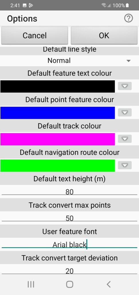
- Line style: Choose line width, continuous or dashed.
- Text colour: Tap coloured bit for any colour or down arrow for list of colours already used.
- Point feature colour: Default icon colour.
- Track colour: Default track feature colour.
- Navigation route colour: Used for Goto line colour at present.
- Text height: User feature default text height. Nominally in map units (metres) but scaled depending on zoom.
- Track convert max points: Not used at present.
- User feature font: Not used at present.
- Track convert target deviation: Not used at present.
GPS options and other display settings.
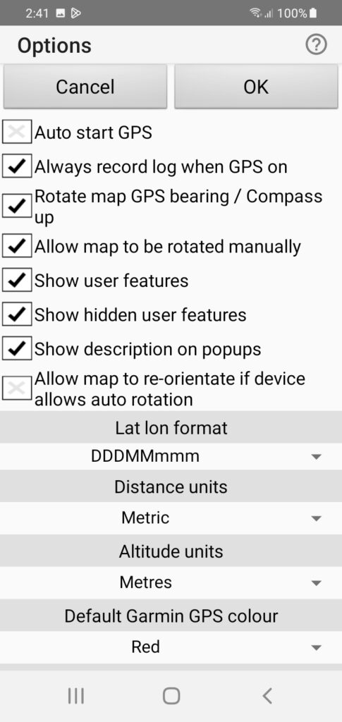
- Auto start GPS: If set starts GPS when app started. Default unset.
- Always record log when GPS on: If set starts recording immediately GPS is activated. Default set.
- Rotate map GPS bearing… : Map rotates to travel bearing up if moving or Compass up if stopped and Compass active. Default set.
- Allow map to be rotated manually: User preference varies. Can also set this with long press on North arrow. Default set.
- Show user features: Shows all visible user features. Default set. Quick set on View menu.
- Show hidden user features: If set shows all features regardless of individual feature visibility setting. Default unset. Quick set on view menu.
Continued…
- Show description on pop-ups: If set shows description when user feature tapped. Default set. Quick set on View menu.
- Allow map to re-orient… : If set allows map to rotate with device orientation. Default unset.
- Lat lon format: Choose lat lon display format degrees + minutes or just decimal degrees. Default degrees + minutes.
- Distance units: Displayed as Metric, Nautical or Statute. Default metric.
- Altitude units: Displayed as Metres, Feet. Default Metres.
- Default Garmin GPS colour: Only relevant if you are sending features to a Garmin GPS.
More GPS options and printing settings
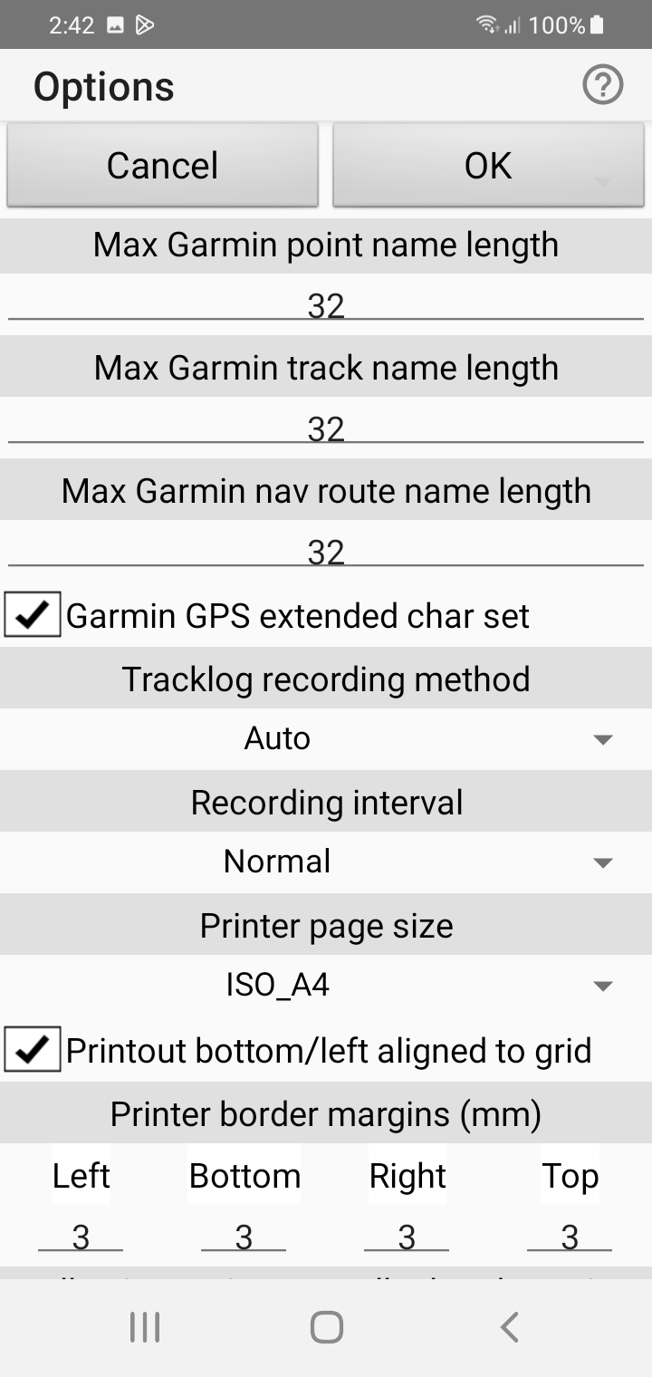
- Four Garmin GPS feature settings. Only relevant if you intend sending features to a Garmin GPS.
- Track log recording method: Choose Auto, Distance, Time. Default Auto.
- Recording interval: Method auto allows more or less record point density. Time, Distance allows you to set actual values.
- Printer page size: Map printing setting. This setting is also used for pdf creation.
- Printout alignment: Choose whether printout is bottom left grid aligned. Default set. Also applies to pdf creation.
- Printer border margins: allowable values vary between printers. Defaults 3mm as shown.
Voice navigation settings
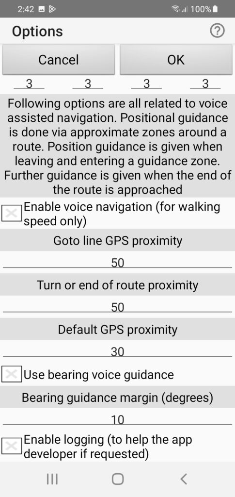
- Note the voice guidance text in the dialog image.
- Enable voice navigation: Set only gives GPS reception messages unless navigating a track or Goto line. Default not set.
- Goto line GPS proximity: Guidance zone radius for a Goto line (metres).
- Turn or end of route … : If navigating a track or Goto line this specifies where to announce turn or route end (metres).
- Default GPS proximity: Guidance zone radius for a route being navigated when not explicitly specified.
- Use bearing voice guidance: Gives route direction change suggestions if set. Default not set.
- Bearing guidance margin: Calculated guidance correction rounded to this multiple.
- Enable logging: Can be set if helping developer with an issue. Email log to developer via Utilities menu. Default not set.