Some general comments about this. I know that to some of you the idea of a robotic voice guiding you through wilderness country will be total anathema. Fair enough but here is an explanation of how it works.
Any of you who have tramped with me will know I wander about the hills with a small Garmin GPS strapped to my wrist. This gives good visual guidance on the fly and leaves hands free. But this is not really practicable with phones as these are bulkier and possibly not weather proof. So voice assistance could enable you to put the phone somewhere nearby to warn audibly if you are off route but leaves your hands and eyes free to manage and observe the terrain.
The app will only attempt to guide you along a track log or GOTO line that YOU have designed, recorded or imported. It does not make any attempt to interpret map contents. It is mostly retrospective – it tells you if you are off route and optionally gives guidance to correct this, but is mostly silent if you are on route. There are some turn guidance suggestions for more complicated routes.
Voice guidance has practical limitations. Firstly the GPS location error is potentially 10 metres or more even in clear sky situations. Secondly it takes the app about 20 – 30 metres travel to accurately establish your current bearing after you change direction. Thirdly the app can take at least 20-30 seconds to detect an issue and then to speak the words. All of this means that voice guidance won’t work well for intricate or hazardous routes where 10 – 20 metre errors are important.
Here are the options relevant to voice navigation.
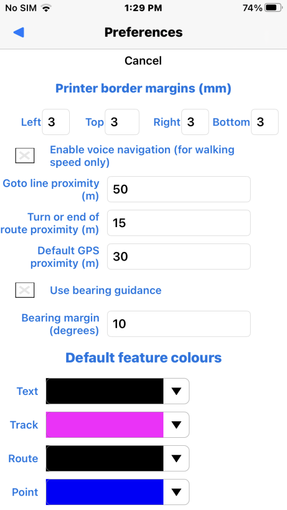
- “Enable voice navigation” sets voice on.
- “Goto line GPS proximity” is the off-route voice warning margin for a Goto line.
- “Turn or end of route proximity” controls destination or turn voice warning.
- “Default GPS proximity” is a default off-route voice warning margin used for navigating a general track user feature if not explicitly set in the feature.
- “Use bearing guidance” checked to get voice bearing suggestions in degrees (true North).
- “Bearing guidance margin” voice bearing suggestions rounded to nearest margin value.
Some examples here.
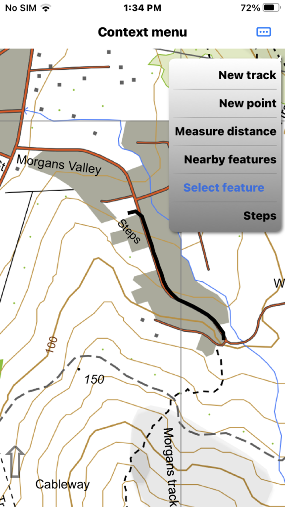
We are starting to navigate a test track called “Steps” without voice. Long press on the track and select from menu.
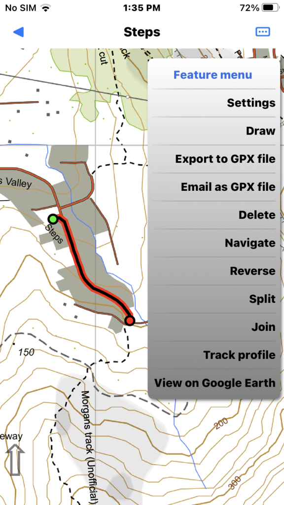
Track “Steps” selected so we select “Navigate”.
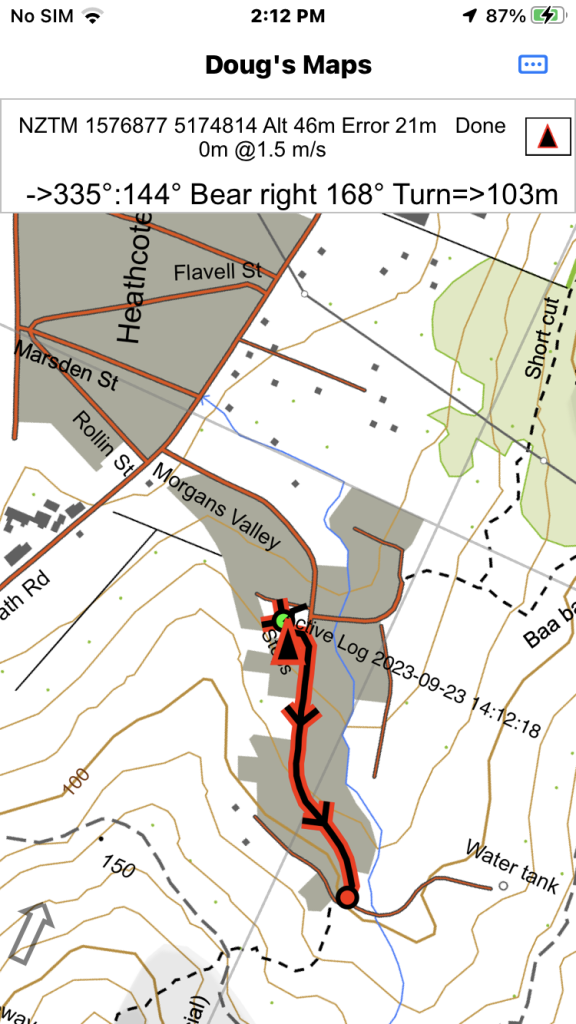
It looks like this without voice navigation. Tap the GPS bar (not near the X) to see navigation info in a slightly larger font.
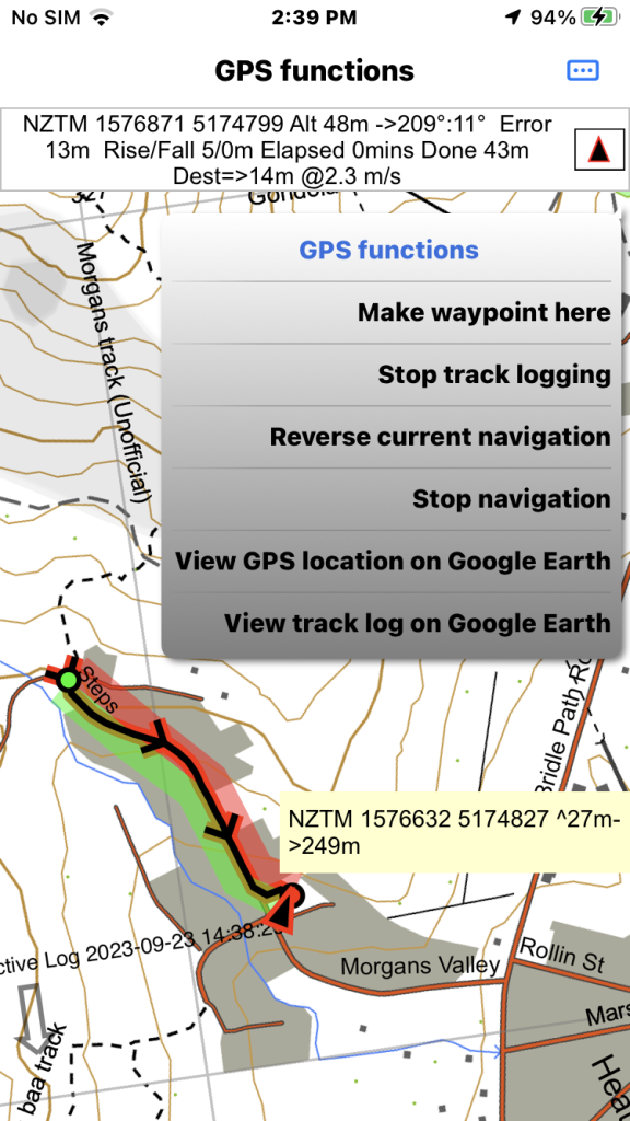
The GPS functions menu has a “Reverse current navigation” item if the track is pointing in the wrong direction.
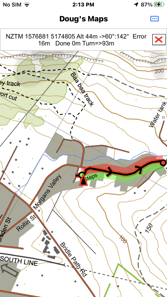
It looks like this if voice navigation is operating. The transparent green/red areas represent the “on route” zone. Zone size is the “GPS proximity” track attribute or the Default GPS proximity value in general preferences.
Here is an example where voice navigation might be useful (West coast fog on the Bonar Glacier). After the southern end of the log the terrain becomes intricate for a while and voice navigation would not be appropriate.