To keep it simple there is a “Print map” menu with a choice of 3 resolutions at each orientation. In the general preferences menu there are settings for page size and print margins defaulted to common values. Printers vary in how much margin can be printed. Most users won’t have an A2 printer but the option allows for an A2 PDF to be commercially printed.
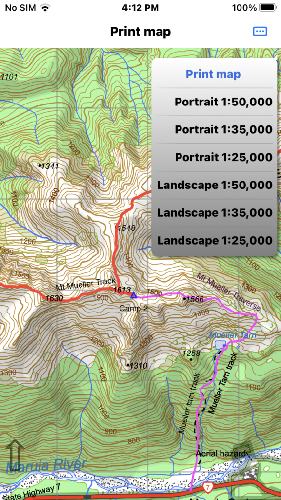
To keep it simple there is a “Print map” menu with a choice of 3 resolutions at each orientation.
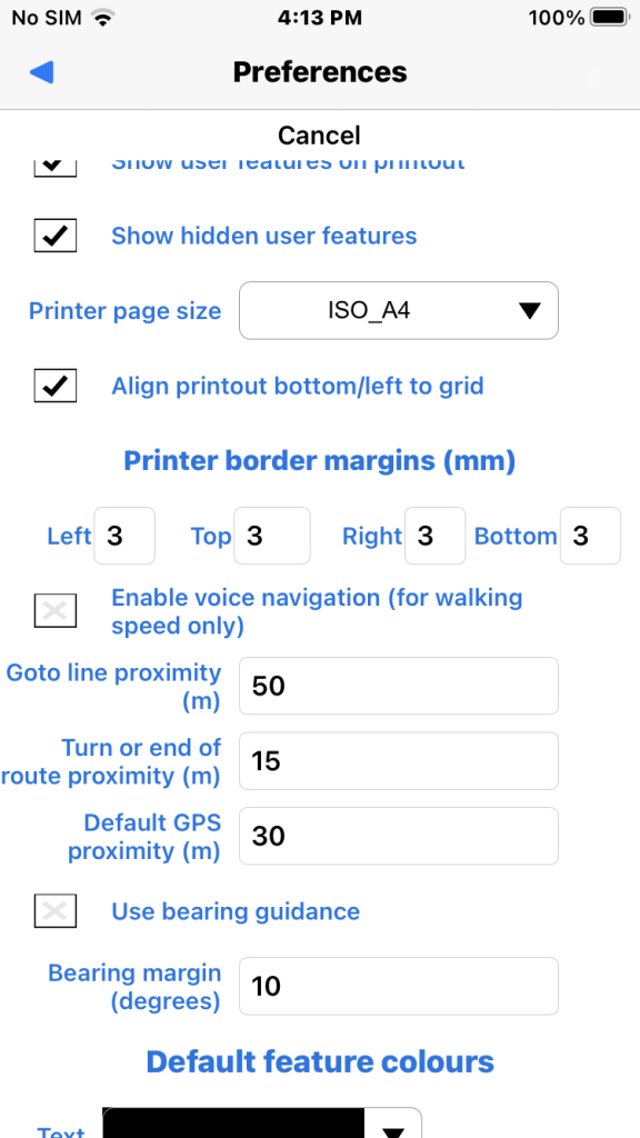
Printer page size choose from A2, A3, A4, A5. Default A4.
Align printout to grid. Default on.
Printable margins. Printers vary, some allow zero.
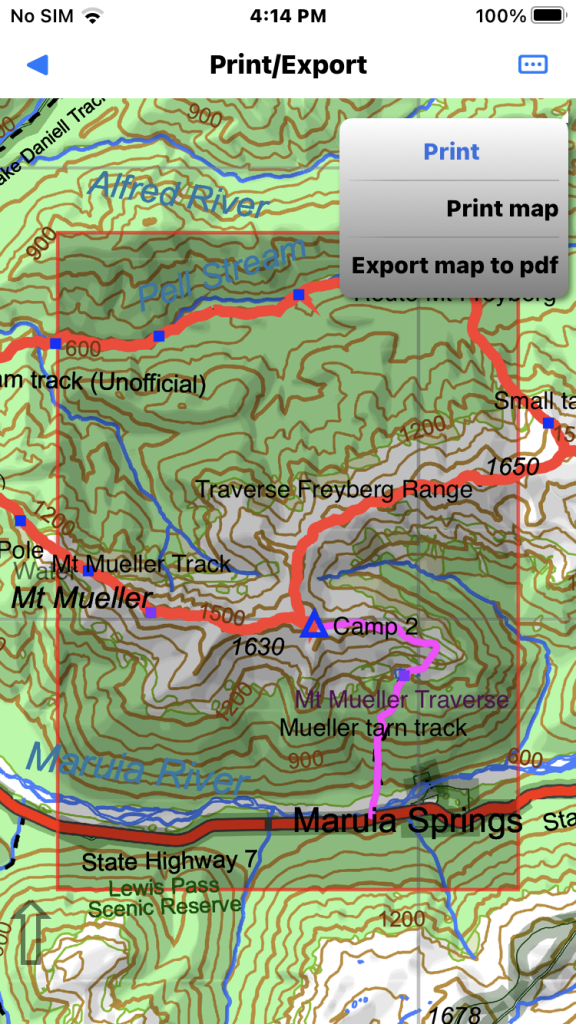
Tapping print causes the screen map to auto scale showing print area centered on map. You can pan the map to change printed area. N.B. the map moves, the preview stays centered but grid aligned if set.
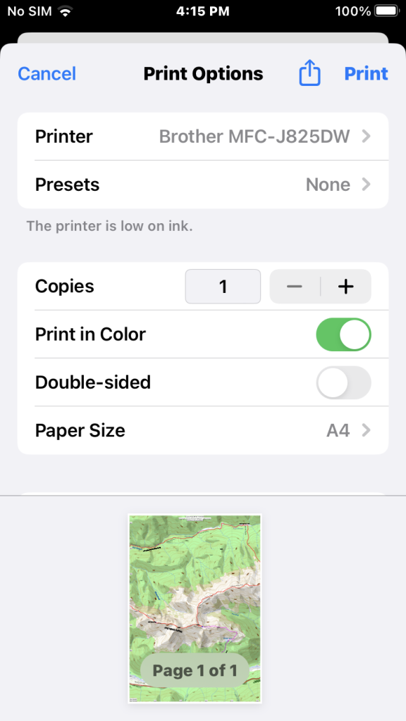
Finally the print dialog. Note the grid alignment. Screen map will auto re-scale back to previous scale after you exit the print dialog.
If you choose “Export map to pdf” from the “Print” menu you see the usual file dialog to save the pdf. The NZTM map name at the center used as default file name.